All 7,000 residents in the Sopwell Ward are automatically a member of Sopwell Residents Association, which means you are welcome to attend our meetings and take part in any of our events.
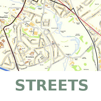

Sopwell’s streets
These streets that are either entirely or partially located in Sopwell ward:
Abbots Avenue
Abbots Avenue West
Albany Gate
Approach Road
Ashby Gardens
Ashdales
Ashwood Mews
Belmont Hill
Berners Drive
Boleyn Drive
Butterfield Lane
Chapel Place
Cloister Garth
Coningsby Bank
Cornwall Road
Cottonmill Crescent
Cottonmill Lane
Creighton Avenue
Cyrils Way
De Tany Court
Deacon Close
Devon Court
Doggetts Way
Dorcas Court
Eywood House
Fernecroft
Glengall Place
Gorham Drive
Grindcobbe
Henrys Grant
Holyrood Crescent
Holywell Hill
Howard Court
Howland Garth
Hudson Close
Kempe Close
Larkswood Court
Latium Close
Leaf Way
Lectern Lane
Leyland Avenue
Mandeville Drive
Martyr Close
Maulden Court
Maynard Drive
Mentmore Road
Mercers Row
Mereden Court
Mitchell Close
Monks Close
Norman Close
Nunnery Close
Nunnery Stables
Nuns Lane
Old London Road
Old Oak
Old Priory Park
Old Sopwell Gardens
Orient Close
Pemberton Close
Praetorian Court
Priory Walk
Prospect Road
Pullman Close
Ramryge Court
Ramsbury Road
Remus Close
Riverside Close
Riverside Court
Riverside Road
Sadleir Road
St Julians Road
Sudbury Court
Tavistock Avenue
Tavistock Close
The Brambles
The Close
The Shrubberies
The Sycamores
Trumpington Drive
Vesta Avenue
Vicarage Close
Wallingford Walk
Watling Street
Watling View
Wilshere Avenue
Sopwell’s Green Spaces
- St Stephen’s Field: The Green area behind St Stephen’s church contains a number of ancient trees, including a Lebanon Cedar rumoured to be where Henry VIII proposed to Anne Boleyn.
- Berner’s Drive Green Space: Sited by the Abbey railway line level crossing, this site houses the former Sopwell Youth Club.
- Pocket Park: Tucked behind the Sub Aqua Club on Cottonmill Lane next to the River Ver.
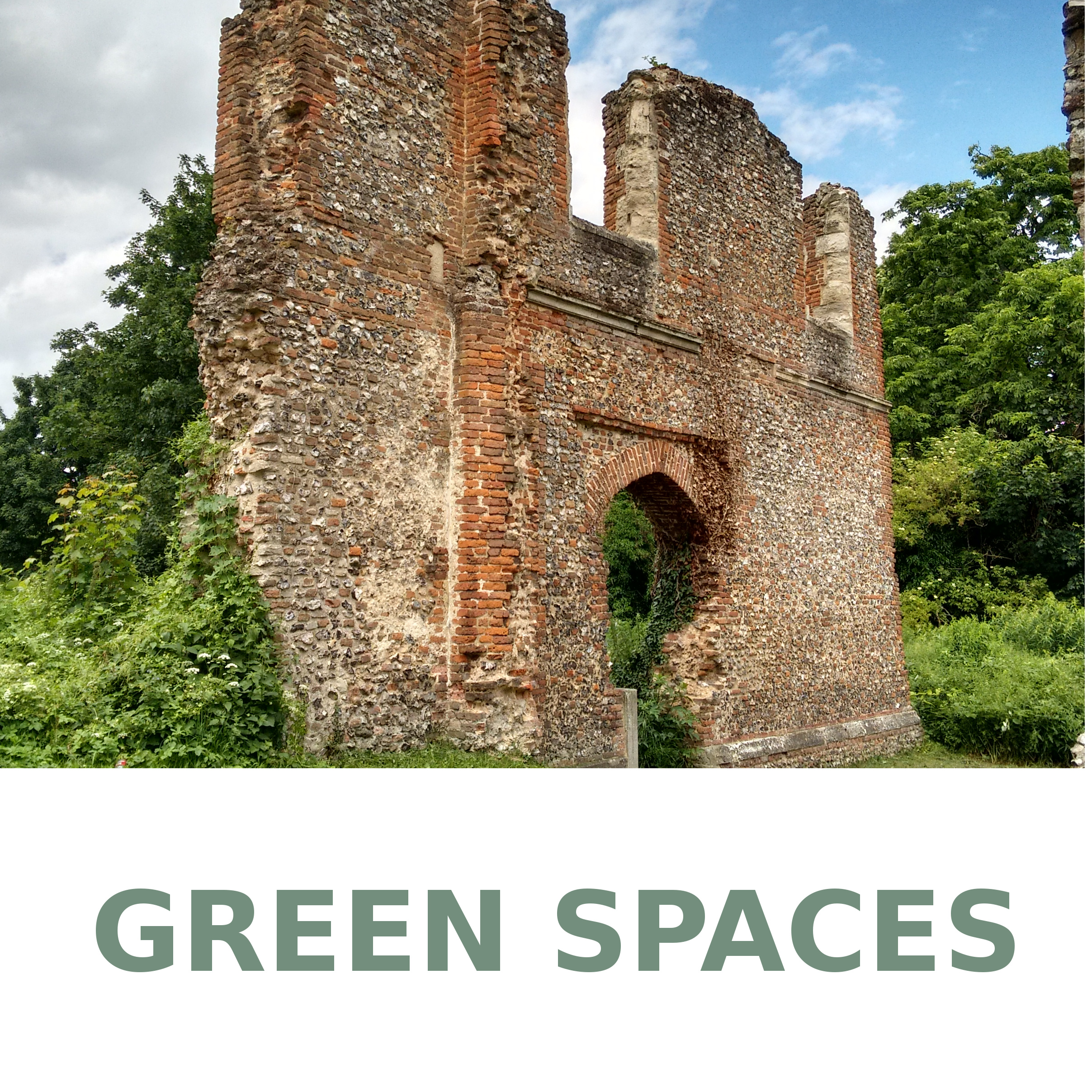
- Sopwell Nunnery: The Tudor ruin site has its own blog and also a page on the St Albans Museums website.
- Sopwell Mill Open Space: Whilst no longer housing a mill, there is a large green space and playground accessible off Cottonmill Lane or the Alban Way.
- Watercress Wildlife Association: A nature reserve on former watercress beds accessible off Riverside Rd.
- Marlborough Pavilion Open Space: Currently a Sports Pavilion and netball court in a large green space accessible from Old Oak, off Cottonmill Lane. The space is bordered by the greenery of grazing land and Verulam Golf Course, and has access to the River Ver. Cottonmill and Sopwell Hub are campaigning for a community centre to be returned to the site.
- Holyrood Crescent Green Space: Field and play area backed by Green Belt farmland.
- Cottonmill and Nunnery allotments: Owned by St Albans District Council and supported by the Cottonmill and Sopwell Nunnery Association (CNAA). There are annual open days where the allotments can be toured.
- The Alban Way: A 6.5 mile walking and cycling route along a former railway line, part of the longer Green Ring that circles St Albans. Accessible off Cottonmill Lane near the Level Crossing.
- The River Ver: A globally rare chalk stream that runs through the Ward. Protected and promoted by the Ver Valley Society.
Transport
Sopwell Ward is serviced by the Abbey Line, running from St Albans Abbey to Watford train stations. More information, including timetables, can be got from the Abbey Line Community Rail Partnership.
Bus routes S4 and S5 run between Sopwell Ward and St Albans Town Centre. Other routes that include or have stops near to Sopwell are the 321, which travels along Holywell Hill and Watling Street, and the 602 route from Hatfield to Watford stops just to the North of the Ward on the Alban Way.
Schools
Sopwell has three mainstream Primary schools and one maintained special school:
Mandeville Primary School, Mandeville Drive, AL1 2LE
St Adrians RC Primary School and Nursery, Watling View, AL1 2PB
St Peters School, Cottonmill Lane, AL1 1HL
Watling View School, Watling View, AL1 2NU
The nearest secondary school, Marlborough Science Academy, is just outside the area on the other side of Watling Street.
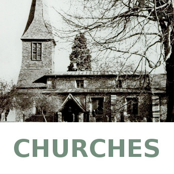
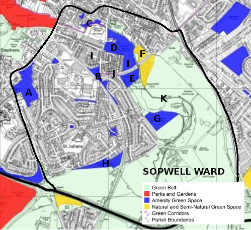
Places of Worship

Masjid Ar Rahman, Abbots Avenue (formerly St Albans Christadelphians)
St Bartholemew RC Church, Vesta Avenue
St Stephen with St Julian C of E Churches, Watling Street and Abbots Avenue
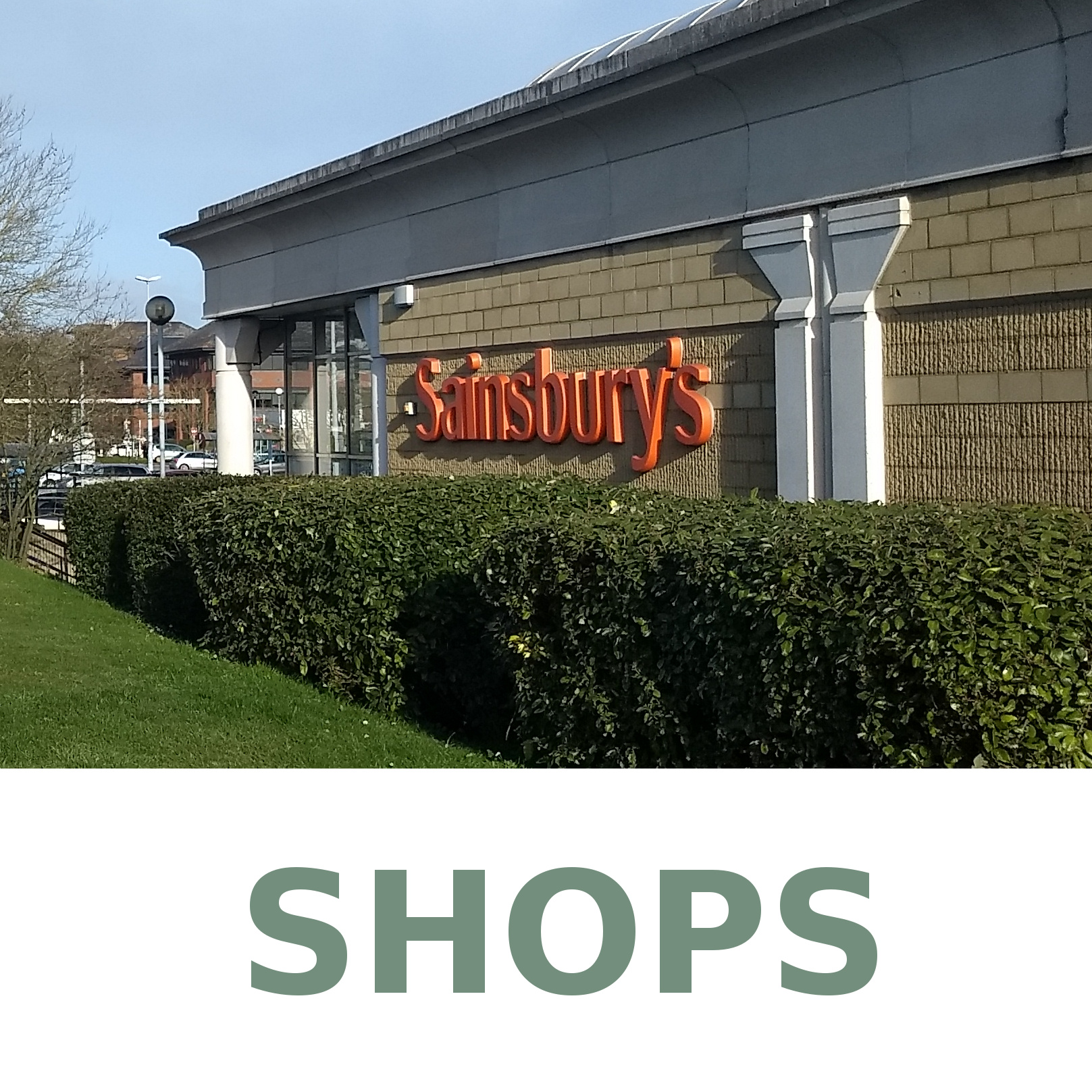
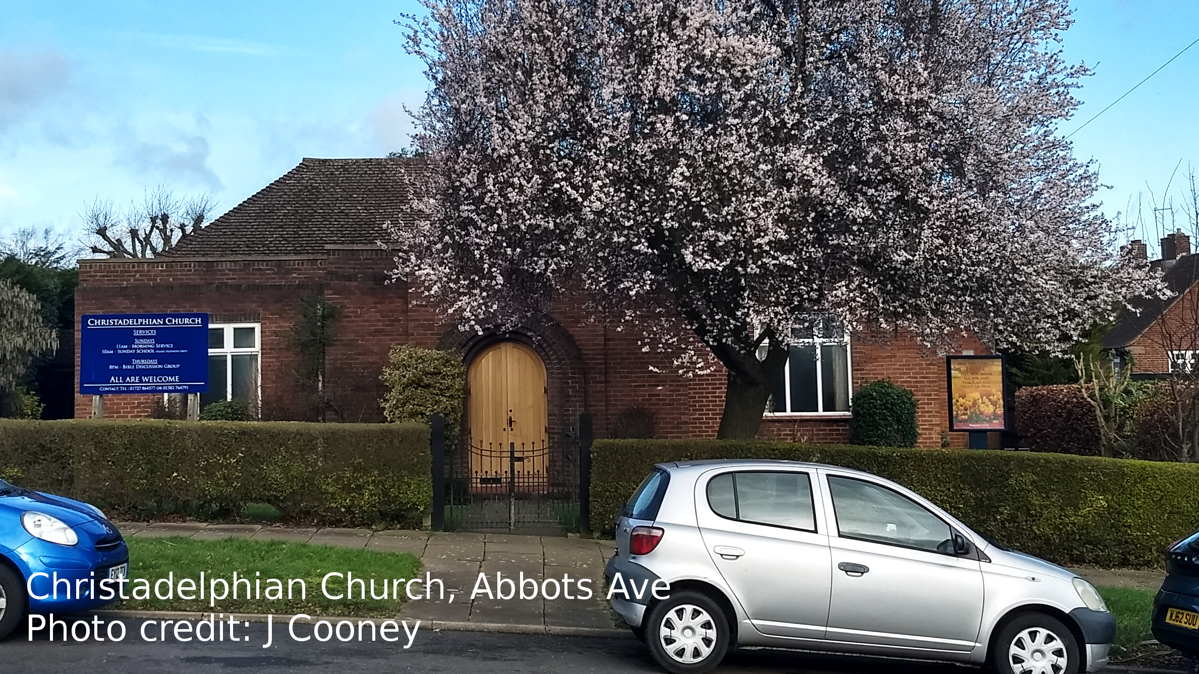
Shops
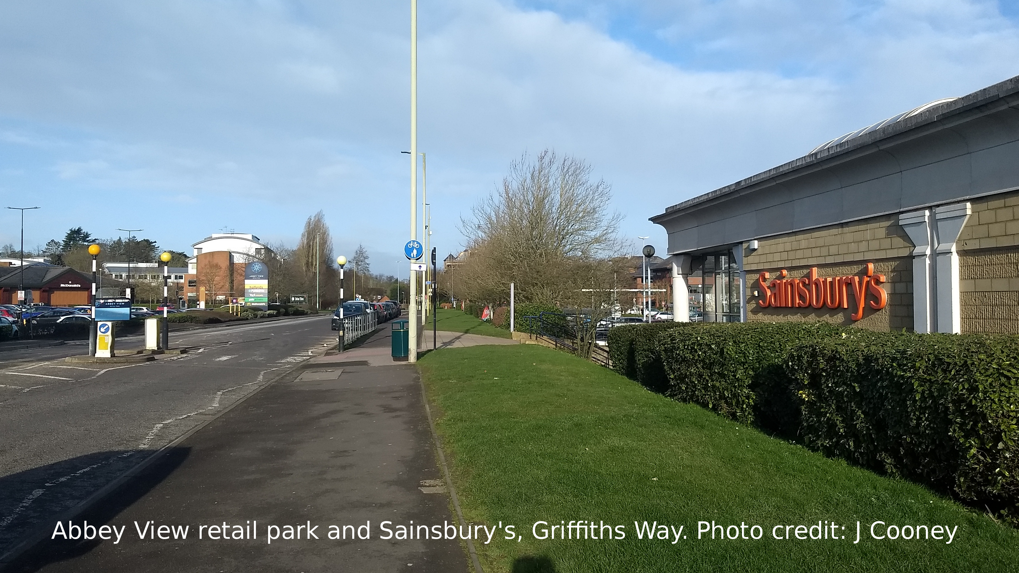
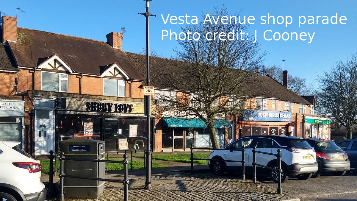
Sopwell has two parades of local shops on Vesta Avenue and Abbots Avenue West. There is also the retail park on Griffiths Way with Abbey View Retail Park, a Sainsburys, the Range and an Aldi built on the site of the former Gasworks.